SINCE first the flight of years began many interesting events have occurred in Yellow Medicine county. And, while the white man's history dates back to no great antiquity, for millions of years history was in the process of making and there were wonderful occurrences- events which were not witnessed by mortal eye, events which a vivid imagination cannot conceive.
From a part of the seething, molten mass that composed the earth during the millions of years about which even the geologist hardly dare venture to guess Yellow Medicine county was formed and became a part of the earth's surface in the process of cooling. Thereafter it was successively covered with the waters of the sea, was raised from the depths to a great altitude, and was crushed back by the weight of the vast ice-sheets during the Glacial Period.
During those times Yellow Medicine county's topographical features were formed, many changes resulting before Nature had them fashioned to her liking. Soil was spread over the surface; ridges and hills were formed' by the action of the ice; depressions were left in which are now lakes; the waters from the melting ice sought avenues of escape and formed rivers and creeks; plant and animal life came into existence.
When Yellow Medicine county was first inhabited by the human species is unknown. Even when the North American continent was first peopled archaeologists can at best only guess. There has been discovered evidence that man lived upon the continent during the decline and closing days of the Ice Age, some 6000 to 10,000 years ago, and probably had done so for a. much longer period. 1
When civilized man first came to the New World he found it peopled with a savage race which he called Indians. They had no knowledge of their own ancestry nor of any peoples who may have preceded them. Whether or not this race supplanted one of a. higher civilization is a question upon which authorities disagree. 2 The only sources of information concerning the early inhabitants are the implements of warfare and domestic use they made, found in burial places and elsewhere in the land. The Mississippi valley is prolific in mounds---the burial places of these ancient peoples,--many having been found and excavated in Minnesota.
Several mounds of Indian origin have been found and surveyed in Yellow Medicine county. In Minnesota Falls township, close to the Minnesota river, were discovered an enclosure, thought to have been the site of a fortified village, and group of mounds of ancient origin.
The location of the enclosure is the northwest quarter of the southwest quarter of section 24, Minnesota Falls township, about one hundred feet above the river. The mounds are a little southeast of the enclosure and are about one hundred feet above the bottom land. Of the enclosure Rev. S. R. Riggs, established a mission nearby in 1854, has written:
The excavation extends around three sides of a somewhat irregular square, the fourth being protected by the edge of the hill, which is now covered by timber. After the filling up of years-, or perhaps centuries, the ditch is still three feet deep [in 1852]. We found the east side, in the middle of the ditch, to measure thirty-eight paces, the south side sixth-two paces, and the west side fifty. The north side is considerably longer than the south. The area enclosed is not far from half an acre. On each of the three excavated sides there was left a gateway of about two paces. The earth was evidently thrown up on both sides, but the embankments have now almost entirely disappeared in the level of the prairie. Within the enclosure there are numerous very slight elevations, which seem to mark the places occupied by the dwellings of those who were once entrenched 'here. It would, be interesting to 'know what were the form and character of those houses. but all we can learn from the present appearance of things is that they were probably partly made of earth. 3
Dr. Thomas S. Williamson, 1852 established a mission on the site of the old Indian fortification, referred its building to the Cheyennes and wrote:
The Sioux who inhabited this valley (Minnesota) forty years ago said that when their ancestors first came to the lower end of the valley they found the Cheyennes in it. Subsequently, perhaps many years, when they came and took possession of it they found the Iowa villages in it, and that the earth mounds are the remains of the earth covered lodges of these Indians whom they expelled. An examination of these mounds indicates that they are the remains of such earth covered lodges as are still occupied by the Mandans and some other Indians of the Mig Muddy. The Cheyennes were then in the upper part of the valley, and near the Yellow Medicine a fortification is still plainly visible which it is said was made by them near a good spring of water, and in 1863. when the first plowing for the Sioux was done in that region, large quantities of mussel shells were turned up near the remains of this fortification, indicating that the ground had been cultivated,
A group of three mounds about the center of the southwest quarter of section 25 and a group of four on the southwest quarter of the southeast quarter of section 24, a short distance south and south-east of the enclosure, have been surveyed, as have also others along the Minnesota river in Yellow Medicine county. 4
In recent years a mound on section 12, Norman township, was excavated to some extent. The Canby News of June 28, 1901, told of the event as follows:
Four skeletons of human beings, the bones of a dog and a buffalo-such has been the ghastly find on the Randine Johnson farm, three and one-half miles east of Canby. .
. . The place where the skeletons were found is a beautiful knoll or mound sloping gradually from all sides to a cone and rising to an elevation of some thirty or forty feet above the surrounding country. The skeletons were in a row and apparently buried in a sitting posture. They were found about seven or eight feet below the surface. It is the west side of the knoll where the digging has been done and only a small part of the gravel has been removed. . .
It would seem that the skeletons had been buried for a long time, as the bones are well decayed, only the larger ones remaining.
While we have little knowledge of the very early peoples who inhabited Minnesota, from the middle of the seventeenth century, when white men first penetrated to the Northwest, we can trace the history of the Indian tribes more or less accurately. At the coming of white men nearly the whole state was occupied by the Dakota or Sioux Indians. 5
At the time of the visit of Father Hennepin to the Northwest in 1680, the Iowas occupied the lower Minnesota, the Shien (Algonquian) and Oujalespuiton the upper Minnesota, the Titonwan the country about Lake Traverse and Big Stone lake, the Ihanktonwan the extreme southwestern corner of the state, and the Otoe the country to the east of the latter. In the extreme northern part of Minnesota were the Kilistino (Crees) and the Monsoni of the Algonquian tribes.
About the middle of the eighteenth century the aggressive Ojibways, or Chippewas, made successful war on the Sioux and Crees, driving the Sioux to the south and the Cress to the north. Thereafter until the white man supplanted the red these two tribes occupied all the area of Minnesota, the Ojibways holding the northeastern wooded half and the Sioux its prairie half on the southwest.
The Sioux nation was divided into many different tribes, of which five occupied Southern Minnesota at the time the whites first became intimately acquainted with them in the twenties and thirties. These five tribes are the only ones with which we have to deal in chronicling this history of Yellow Medicine county and were named M'dewanktonwan, Warpekute, Sissiton, Warpetonwan (Wahpeton) and Ihanktonwan (Yankton). The location of these several bands in 1834 has been told by Rev. S. W. Pond, who came to Minnesota that year. He has written:
The villages of the M'dewakantonwan were on the Minnesota and Mississippi rivers, extending from Winona to Shakopee. Most of the Indians living on the Minnesota, river above Shakopee were Warpetonwan. At Big Stone lake there were both Warpetonwan and Sissitonwan, and at Lake Traverse Ihanktonwan [Yankton], Sissitonwan and Warpetonwan. Part of the Warpekute lived on Cannon river and part on Traverse des Sioux [near the present city of St. Peter]. There were frequent intermarriages between these divisions of the Dakotas, and they were more or less intermingled at all their villages. Though the manners, language and dress of the different divisions were not all precisely alike, they were essentially one people. 6
The history of Yellow Medicine county before the white race took possession must be left almost entirely to the imagination; there are little data from which to write it. 1f inanimate things could speak, what wild tales of Indian adventure could be poured forth! But inanimate things cannot speak and the animate aborigine is a notoriously worthless historian, so a very interesting part of the history of Yellow Medicine county must forever remain unrecorded. Only trifling bits of history, intermingled with a plethora of legend, are preserved of the days before the Caucasian race took possession.
Among the numerous conflicts that took place between the Chippewa. And Sioux tribes in the (lays before the historian came to the land, one at least is believed to have taken place on Yellow Medicine county soil. On section 8, Swede Prairie township, Knute Glaim in the early nineties plowed up a number of stone arrow heads and a stone ax of a black color and other Indian relics. The stone was a kind used exclusively by the Chippewas, and the spot is supposed to be the site of a battle participated in by that tribe. A number of bones were also unearthed on the same farm. On section 18 of the same township N. O. Carle found a well preserved stone image about three feet high. On the upper Yellow Medicine 21fine black stone pipe was discovered. 7
Another reminder of aboriginal days was in evidence when the first whites came to the county--a deeply worn trail along the south side of the Minnesota river. J. L. Putnam in the Granite Falls Tribune of December 29, 1896, has told of it:
Nearly a quarter of a century ago an Indian trail, conspicuously plain along the banks of the Minnesota, wound its course from this small burg to New Ulm. Few traces of it can 'now he discovered, but twenty years ago we distinctly remember following it several miles; in some places it was worn down into the rock to quite a depth. No question but thousands of red men traveled it long before a white man intruded and defaced it to make improvements and erect buildings. Deer and antelope would follow this trail for many miles in the primitive days when no hunter scared them away. Things have changed and no longer is there a vestige of the lndian trail once so plainly visible.
Such is the limited data from which we have to write the pre-Caucasian history. But we can, in imagery, take a look at the Yellow Medicine county of' years gone by, when it was in primeval state, when it was as Nature had formed it. Its topography was practically the same as we find it today. There were the same broad, rolling prairies, stretching as far as the eve might reach, presenting in summer a perfect paradise of verdure, with its variegated hues of flowers and vegetation: in winter a dreary and snow-mantled desert. The rivers and creeks flowed in the same courses as now: the lakes occupied the same banks as at the present day. But what a contrast!
Wild beasts and birds and wilder red men then reigned supreme. Vast herds of bison, elk and deer roamed the open prairies and reared their young in the more sheltered places along the streams. With that wonderful appreciation of the beautiful which Nature has made an instinct in the savage. the untutored Sioux selected the country as his hunting ground and roamed it at will. Such was the Yellow Medicine county before the march of civilization brought: the white man to supplant the red.
Before introducing the first white man who set foot on the soil of Yellow Medicine county, let us review briefly the explorations that had been made in other parts of Minnesota.
White men first penetrated the Northwest country to the present state of Minnesota in the middle of the seventeenth century (1655-56). In 1683 the first map on which physical features of Minnesota were pictured was published in connection with Father Hennepin's writings. The map is vague and demonstrates that little was known of the Northwest country; the Minnesota river did not have a place and that stream was not mentioned in Hennepin's book of travels.
Joliet, Marquette, LaSalle, DuLuth and other French explorers visited the Northwest during the last part of the seventeenth century, but none of them visited the Minnesota river section or even had evidence of the existence of the stream. The river which bounds Yellow Medicine county on .the northeast is first mentioned in a document prepared by Nicholas Perrot in 1689 commemorating the formal taking possession of the country. It was referred to as the river St. Pierre. Later it was given the English spelling, St. Peter, and by legislative enactment in 1852 became the Minnesota.
Before the seventeenth century brought to a close, however, the Minnesota river was destined to be explored. LeSueur, who had first visited the upper Mississippi country in 1683 with Perrot, built a trading post at Isle Pelee, in the Mississippi river, nine miles below the St. Croix, in 1695 and at that time made the first exploration of the Minnesota river. He obtained the idea that there were copper mines on the Minnesota and in 1699, with a commission from the king of France, he set out for the "mines," making the trip from France to the settlements on the lower Mississippi.
In April, 1700, with it company of about twenty-five persons he set out from the settlement on the lower Mississippi with a single shallop. On the nineteenth of September he reached the mouth of the Minnesota river and on the last day of that month, having reached the Blue Earth river, he built a fort in which he spent the winter, Fort L'Huillier, named for one of the chief collectors of the king of France, was a league up the Blue Earth river. A short distance from the fort the Frenchmen gathered large quantities of blue or green earth, which they believed to be copper ore. In the spring of 1701 LeSueur with a part of his force descended the Mississippi with the "ore," 4000 pounds of which were taken to France. The garrison which had been left at Fort L'Huillier. thirteen in number, having received ill treatment at the hands of the Indians and having run short of provisions, in 1702 returned to civilization.
The data secured by LeSueur were used in the preparation of a map of the Northwest country by William De L'isle, royal geographer of France, in 1703. Several of the larger and more important physi1cal features of Southwestern Minnesota were more or less accurately located. For the first time the Minnesota river appeared on a map, being labeled R. St. Pierre, or Mini-Sota. There is nothing in the writings of LeSueur, however, to lend to the belief that he extended his exploration to any country except along the Minnesota river and not much further up that stream than the mouth of the Blue Earth.
During the next sixty-six years after LeSueur visited the Minnesota river, no white man was in Southwestern Minnesota, so far as we know. Then, in November, 1766, Jonathan Carver ascended the Minnesota and spent seven months with the Indians at the mouth of the Cottonwood river, in the. vicinity of the present city of New Ulm. He remained with the Indians until April, 1767, and learned their language. 8
It is possible that Carver during this time may have visited the country which is now included within the boundaries of Yellow Medicine county, for be hunted with the Indians over some of the great plains of Southwestern Minnesota, which, "according to their [the Indians'] account, are unbounded and probably terminate on the coast of the Pacific ocean." 9
We have no record of explorers proceeding so far up the Minnesota river as the future Yellow Medicine county until 1823, but it is highly probable that, during the closing days of the eighteenth century white men had set foot on its soil, for traders that early were operating among the Sioux of the Minnesota valley. The principal traders at that early time were Murdoch Cameron. Dickson, Campbell, Aird and Crawford. During the early years of the nineteenth century the trade with the Indians became an extensive industry, and many operated in the Minnesota valley.
Jean Baptiste Faribault, born in Canada in 1774, began to trade in the Minnesota valley about 1800, and in 1816 J. H. Lockwood, born in New York in 1793, began operations there. being among: the first American born traders. We learn that he proceeded up the Minnesota by boat and in December, 1816, reached the Lac qui Parle river. 10
Besides the operations of these early traders, we have evidence of the visit to the. future Yellow Medicine county of a. party of white men in 1820. A party in charge of Laidlaw from Lord Selkirk's settlement near Lake Winnipeg was sent during the winter to Prairie du Chien, the nearest farming settlement in the United States, to procure seed wheat. They were three months making the journey, purchased 200 bushels of wheat, and an April 15 started out in three Mackinaw boats to make the return journey by way of the Minnesota river. They ascended the river to Lake Traverse, descended the Red river, and reached the settlement in June.
In 1822 the Columbia Fur Company was organized by Joseph Renville, Jeffries, Laidlaw and Prescott and a central post was established on Lake Traverse. During the short life of this company it operated all through the upper Minnesota valley and the county of Yellow Medicine was frequently visited by its traders.
The American Fur Company, of which John Jacob Astor was one of the directors, purchased the post and good will of the Columbia Fur Company a short time after the founding of the latter. Under the new arrangement a trading post was established on the Lac qui Parle river, near its junction with the Minnesota--only a short distance from the future Yellow Medicine county-and Joseph Renville placed in charge. Ezekiel Lockwood was also_ a licensed trader there in 1826 and 1827. Mr. Renville spent the rest of his life at Lac qui Parle. 11
The upper Minnesota was explored under government direction in 1823, and for the first time the physical features of Yellow Medicine county were examined by scientific men. Major Stephen H. Long, who had in 1817 visited the falls of St. Anthony, was that year directed by the secretary of war to conduct a party of exploration to the source of the St. Peter's (Minnesota) river and down the Red river to Lake Winnipeg. He was accompanied by a number of scientific gentlemen from Philadelphia, including Professor William Keating, of the University of Pennsylvania, who was the historian of the party.
Long and his associates proceeded up the Minnesota to Traverse des Sioux (near the present site of St. Peter), where they abandoned their canoes, and then followed the trail westward, cutting off the great bend where the Blue Earth enters the Minnesota. Thereafter they traveled by land on the south side of the river, recording various interesting observations respecting the fauna and flora of the prairies.
On the afternoon of the eighteenth of July, 1823, Major Long and his party entered the future Yellow Medicine county. At a point a few miles below the mouth of the Yellow Medicine river they came to the rocks. This is what Professor Keating wrote of them at the time of the visit ninety years ago:
When descending into the valley from the prairie with a view to select a suitable spot for our evening's camp, our attention was suddenly called to the new features which it displayed. High rocks of a. rugged aspect arose in an insulated manner in the midst of the widened valley through which the St, Peter winds its way. We spent the rest of the afternoon in examining them and experienced no little satisfaction in finding them to be primitive rocks in situ.
. . . These rocks are not very extensive; the circumference of the largest probably does not exceed one-quarter of a mile; they rise to about thirty-fire feet above the level of the water. Their form is irregular; their aspect rugged and barren compared with the fertile bottom of the valley; their general color is of a dark gray; they appear to be the summit or crest of primitive rocks which lie beneath this valley and which protrude at this place through the superior strata. As the adjoining prairies are elevated about fifty feet above the level of the river, these primitive rocks are observable only in the valley; they doubtless constituted' at one time a continuous ridge, but have been divided into insulated masses by the corroding action of the stream, whose very circuitous bed winds between them. They extend a distance of about six miles in the direction of the valley.
. . . The discovery of this granitic formation here appeared the more interesting as its small extent might easily have prevented us from observing it had not chance brought us to the river at this place: for if we had been traveling on the prairie within half a mile of the edge of the bank. the greater height of the bluff would have concealed those rocky islands from our view. We feel, therefore, unable to decide whether they do not occur at some other bends of the river which we avoided: yet from the character of the stream itself we doubt it. For we find that as soon as these rocks protrude into the valley, they occasion rapids and falls in the river. 'while otherwise its course is smooth.
The party made careful examination of the falls and rapids in the vicinity of Granite Falls before continuing the journey up the river. Continuing the narrative, Professor Keating wrote:
The recurrence of these primitive knobs disturbs the current of the river and makes navigation difficult and hazardous. Five miles below the encampment of the nineteenth there is a place where the boats and their loads are carried for the distance of a mile, from which circumstance the place is called the Grand Portage. By this portage the canoes avoid thirteen rapids; these with twenty-six other rapids constitute all the obstructions to navigation of the river from its source to its mouth. In a good stage of the waters there are, however, but two portages, of which this is one. Among the tributaries passed that day only one deserves to be mentioned. It is called the Pejehata Zeze Watapan (Yellow Medicine). It is about the same size as the Redwood and rises, in like manner, at the base of the Coteau des Prairies. Nearly opposite to it a small stream falls in; the Indians call it. the Chataba (that hatches sparrow-hawks); the traders term it L'Eau de Vie. On our map we have retained the name Epervier, which being in use among some of the traders and intelligible alike to both French and English travelers, appears likely to prevail. 12
Further up the Minnesota the explorers noted the Chippewa river coming in from the north, which they believed to be interlocked with the headwaters of the Red river. They also noted "Beaver rivulet" (Lac qui Parle river), joining the Minnesota near the foot of Lac qui Parle, which was described as a widening of the Minnesota similar in Lake Pepin of the Mississippi river. Above the lake they described the Minnesota to be only a rivulet from twenty to thirty feet wide and very much obstructed with high grass, wild rice and stagnant water.
It was eight years later when the next party of explorers under government direction visited the upper Minnesota country and set foot on the soil of Yellow Medicine county. At the head of the party was George W. Featherstonhaugh, described as a growling Englishman. He bore the title United States geologist and was commissioned by Colonel J. J. Abert, of the Bureau of Topographical Engineers. His assistant was Professor W. W. Mather.
The party departed from Fort Snelling September 16, 1835, with Milor as guide and interpreter, reached Traverse des Sioux September 20, the Blue Earth river on the twenty-second, and toward the close of the month were at the home of Joseph Renville at Lac qui Parle. On October 4 the Fcailici'stonlia11gl1 party reached the trading post of Joseph R. Brown at the foot of Lake Traverse and then began the return journey, stopping on the eighth at Renville's. They reached Fort Snelling on the sixteenth. Featherstonhaugh explored parts of the Coteau des Prairies, that elevated ridge extending for a distance of 200 miles northwest by southeast in Dakota and Southwestern Minnesota. 13
In 1835 the Presbyterian mission was established at Lac qui Parle and proved to he an important event in the history of Yellow Medicine county, although the original location was some dozen miles beyond the confines of our county. Later the mission was moved to Yellow Medicine county, and its history here will be gone into more fully. Because of its proximity to the future county, with which we are dealing and its influence on the savages of the upper Minnesota valley, a brief story of the Lac qui Parle mission may not be out of place here.
In 1834 Rev. Thomas S. Williamson, who previous to his ordination had been a physician in Ohio, was appointed by the Board of Foreign Missions to visit the Sioux Indians to ascertain the prospects of introducing the Christian religion. He investigated and reported the field favorable. The Presbyterian and Congregational churches, through their joint missionary society, then appointed the following persons to labor in Minnesota: Rev. Thomas S. Williamson, missionary and physician; Rev. J. D. Stevens, missionary; Alexander Huggins, farmer; and their wives as assistants; Sarah Poage and Lucy Stevens, teachers. The state of navigation prevented them taking up the work that year, but in Mar. 1835, Dr. Williamson and his workers arrived at Fort Smelling.
Two points were selected by the missionaries, Rev. Stevens and family located at Lake Harriet, and in June Dr. Williamson and family proceeded to Lac qui Parle, where they were welcomed by Joseph Renville, the trader who for more a decade had been in charge of' the trading post there. Dr. Williamson erected a one-room dwelling house, and in it in the latter part of July, 1835, was begun the first school taught in Minnesota outside of Fort Snelling. Miss Sarah Poage, who subsequently became the wife of' Rev. Gideon Pond, was the teacher. The pupils were Indians and mixed bloods and the teaching: was in English. On September 15 of the same year a Presbyterian church was organized, of which Joseph Renville and wife were communicants. This church has never become extinct. It was moved to Yellow Medicine county in the early fifties, was forced to suspend at the time of the massacre, but became the parent of several other churches in the valley of the upper Missouri.
Dr. Williamson began a school for teaching to read the Dakota language in December, 1835, in a large tent belonging to Mr. Renville. The pupils were twenty in number and all men-most of them relatives of the trader. Some of the pupils were too old to learn and the average attendance was only about six.
From the spring of 1836 until the spring of 1839 Rev. Gideon H. Pond assisted in the work at the mission and then returned to Lake Harriet. Rev. S. R. Riggs joined the mission in 1837, and during the winter of 1839 Rev. Daniel Gavin, a Swiss-Presbyterian missionary , was at Lac qui Parle. About 1840 a new meeting and school house, 24x36 feet, was erected at the mission. It was of unburned brick, with a shingled roof, was plastered on the walls inside, was veiled with boards, and had folding partitions. It was occupied until the mis-
sion was moved in 1854. In 1851 there were living at the Lac qui Parle mission Rev. S. R. Riggs and Rev. M. N. Adams, missionaries; Jonas Pettijohn, Mrs. Fannie Pettijohn, Mrs. Mary Ann Riggs, Mrs. Mary A. M. Adams and Mi.ss Sarah Rankin, assistants.
The Church of Rome had a missionary at Lac qui Parle during the winter of 1841-42. He was Father Ravoux, who had recently come from France. After a short sojourn at Mendota he moved to Lac qui Parle, preached to the natives a few months, and then withdrew. 14
If we except the fur traders and the missionaries at Lac qui Parle, very few white people visited the future Yellow Medicine county during the late thirties and forties. In 1837 George Catlin, the famous traveler and Indian delineator, made a trip to the Pipestone quarries but did not touch Yellow Medicine county, although he passed through Lyon county.
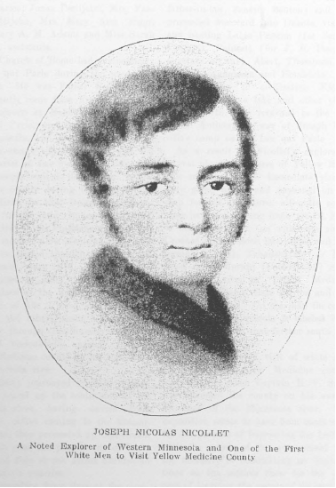
The next year, 1838, J. N. Nicollet, accompanied by John C. Fremont, later the nominee of the Republican party for president of the United States" Joseph Renville and others, made a trip of exploration through Southwestern Minnesota and undoubtedly passed through Yellow Medicine county on his way down the Minnesota river.
This party journeyed over the general route of travel up t-he south side of the Minnesota. river, having started from Mendota. After coming to the Cottonwood river, they proceeded up that stream to a. point near the present site of Lamberton and then struck across country to the Pipestone quarries.
After spending three days at the quarries, where is now situated the city of Pipestone, the Nicollet party visited and named Lake Benton (for Mr. Fremont's father-in-law, Senator Benton) and then proceeded westward into Dakota, visiting and naming Lakes Preston (for Senator Preston), Poinsett (for J. R. Poinsett, secretary of war), Abert, Thompson, Tetonkoha, Kampeska and Hendricks. Before returning to civilization Nicollet visited Big Stone lake and other places to the north. He returned to the falls of St. Anthony by way of Joseph Renville's camp on the Lac qui Parle
As a result of Nicollet's exploration several physical features of Yellow Medicine county and the immediate vicinity were given names and appeared on the map for the first time, all quite accurately located. Among them are St. Peter or Minisotah river (on which are shown Crooked rapids, Rock Bar rapids and Patterson's rapids), Tehanshayapi or Redwood river, Waraju [Cottonwood] river, Pejuta Zizi river or Yellow Medicine river, Lake Shetek, Lake Benton and Red Pipestone quarry. On the map the country along the Minnesota is labeled Warpeton country and that farther south Sissiton country.
The next recorded visit of white men to the future Yellow Medicine county was in 1845, when Captain E. V. Sumner traversed the county on his way to the head of the Minnesota river. The expedition seems to have been made more for the purpose of impressing the Indians with the power of the government and the necessity of committing no depredations on the settlers than for the purpose of learning the nature of the country.
Captain Sumner left Fort Atkinson June 3, 1845, and arrived at Traverse des Sioux nine days later, having been joined on the way by Lieutenant J. Allen. 15 The companies continued together from that time. From Traverse des Sioux they marched to Lac qui Parle, where Captain Sumner had an important conference with the Warpeton Sioux, whom he distinguished as the Upper Sioux. He reached Big Stone lake on the fifth of July, where he met in council a large band of Sissitons. He reached Devil's lake, on the forty-eighth degree of latitude, on July 18, where he had a conference with a party of Winnipeg half-breeds, numbering about 180. He reached Traverse ides Sioux on the seventh of August, whence he repaired to Fort Atkinson on the eleventh, Lieutenant Allen returning to Fort Des Moines.
From events so far recorded it can be seen that up to the middle of the nineteenth century the general knowledge of the upper Minnesota valley country was extremely limited. So far as Yellow Medicine county was concerned, white men had never established a home therein and not a. great many white people had even trod its soil. Renville and other traders were doubtless more or less acquainted with some of its principal physical features, and probably the missionaries at Lac qui Parle had traveled over parts of it--certainly they had along the Minnesota river.
Excepting what these few people far out in the Indian country knew, we find that when Minnesota Territory was formed "in 1849 all its territory excepting portions within a. small radius of St. Paul was a veritable terra incognita. 16 In fact, all the land west of the Mississippi river was still in undisputed ownership of the Sioux bands, and white men had no rights there whatever except on suffrage of the wild men of the plains. But the tide of immigration to the West had set in and settlers were clamoring for admission to the rich lands west of the river. In time the legal barrier was removed.
"The original peopling of America appears to have taken place far longer ago by migration from Northeastern Asia during the early Quaternary or Ozarkian Epoch or general uplift of northern regions. which immediately preceded the Ice Age and which continued through the early and probably the greater part of that age. Then land undoubtedly extended across the area of Behring sea.
"During Ozarkian time and the long early part of the Glacial Period, wandering tribes, migrating for better food supplies or to escape from enemies, could have crossed on land from Asia to Alaska and could have advanced south to Pategonia and Tierra del Fuego, occupying all the ground (excepting the ice-covered area) that is now, or was in pre-Columbian times, the home of the American race. It is not improbable, too, that another line of very ancient migration, in the same early Pleistocene or Quaternary time, passed from Western Europe by the Faroe islands, Iceland and Greenland to our continent."
2 - "It was formerly thought by many archaeologists, twenty-five to fifty years ago, that the mounds of the Ohio and Mississippi valleys were built by a prehistoric people, distinct from the Indians and further advanced in agriculture and the arts of civilization. To that ancient people the name of Mound Builders was given, and it was supposed that they were driven southward into Mexico by incursions of the Indian tribes that were found in our country at the first coming of white men. This view, however, has been generally given up. The researches of Powell and other specialists, including Winchell and Brower in Minnesota, have well referred the building of the mounds to the ancestors of the present lndians."---Warren Upham in Minnesota in Three Centuries.
3 - Concerning this enclosure and Rev. Riggs' description, N. H. Winchell, in The Aborigines of Minnesota, has written: "From this description, compared with the ruins of the palisaded villages of the Omaha, it is possible, in the light of later researches, to answer the query of Mr. Riggs with some degree of assurance, and to refer the fortification to the custom of the Dakota tribes of fortifying their villages by upright palisades set in the earth and strengthened by piling earth along their bases on both sides. It is probable that most, or many, of the so-called 'forts' and entrenchments which distinctly enclose an area, supposed to have been constructed in defense against an encroaching enemy, are the ruins of such palisaded villages, the ditch which still remains being on the inner side of the palisades. The 'slight elevations' are the remains of earthen houses."
4 - Other mounds surveyed were as follows: Se� of se� 23, Minnesota Falls, 52x4 feet: nw� of sw� 29, of the fraction of Sioux Agency. 52x7 feet: se� of se� 29, of the fraction of Sioux Agency. 33x2 feet; sw� of sw� 28, of the fraction of Sioux Agency. 25x2 feet: se� of se� 24, Minnesota Falls, 60x5 feet; nw� 30, of the fraction of Sioux Agency, 42x3 feet; se� of ne� 30, of the fraction of Sioux Agencv, 45x3 feet; stone circles on section 33, of the northern fraction of Stony Run township; group of ten mounds on w� of se� 15, Minnesota Falls: two mounds on e� of nw� 15. Minnesota Falls, largest 60x6 feet, ne� of ne� 9. Minnesota Falls, 35x3 feet; se� of ne� 9, Minnesota Falls, 62x5 feet; sw� of sw� 10, Minnesota Falls, 42x2� feet; se� of sw� 19, of the northern fraction of Stony Run, 40x2� feet; sw� of sw� 13, Stony Run, 50x2� feet; ne� of sw�, 11, Stony Run, 42x4 feet; nw� of nw� 24, Stony Run, 40x2 feet. There are also a number across the river in Chippewa county.
5 - The Dakotan stock embraced many tribes and according to Indian tradition came from the Atlantic seaboard. Their original homes, according to the best authorities, were in the Carolinas, Virginia, and possibly portions of the Gulf coast. Into that region formerly the buffalo ranged. It is suggested that the quest for food probably led the Dakotas to follow the movements of that animal and thus in time to possess the country west of the Mississippi river.
The migration, which occurred several centuries before the discovery of America, covered a great length of time and was by way of the Ohio valley, which was the home of the Dakotas at one time. Some authorities assert that the Dakotan stock built at least a part of the celebrated mounds of the Ohio valley, as well as those of eastern Tennessee and West Virginia.
The most important branches of the Dakotan stock that migrated to the West are given as follows (abridged) in The Aboriginies of Minnesota, published by the Minnesota Historical Society in 1911:
"Hidatsa. The Minitari or Gros Ventres of the Missouri valley. Probably the first of the expelled Mound Builders to reach Minnesota.
"Crows, or Absaruka, or Upsarata. Still further up the Missouri river.
"Mandan. On the Missouri river.
"Sioux or Dakota. Embraced Santee (Issanti), Sissiton, Vvahpeton, Yankton, Yanktonai, Teton (embracing Brule, Sans Arcs, Blackfeet, Minneconjou, Two Kettles, the Ogallala and the Hunkpapa) and the Assiniboin, or Stone Sioux.
"Winnebago. Originally in Central Wisconsin and Northwestern Illinois and later in Northern Minnesota and Iowa.
"Omaha (Maha) and their kindred, Ponca, Osage, Kwapa and Kansa. Formerly of the Ohio and Wabash rivers. Later in Missouri, Kansas and Nebraska, sometimes extending their domains temporarily to Minnesota and the Black Hills.
"Iowa (Dustv Heads). Included also the Otoe and the Missouri. Along the Mississippi river north of the Missouri, along the Des Moines river, and temporarily in Minnesota."
The word Dakota, by which the Indians preferred to be designated, signifies allies, or joined together in friendly compact. But from the earliest days the nation has been more commonly referred to as Sioux, a word of Ojibway origin and bestowed by the French voyageurs. For centuries the Ojibways of the Lake Superior country waged war against the Dakotas and whenever they spoke of the latter they called them Nadowaysioux, which signifies enemies. The Frenchmen nicknamed the Dakota Sioux, a contraction of the Ojlbway word.
6 - There was little change in the locations of the villages of these tribes from 1834 until after the reservations were prepared for them as a. result of the treaty of 1851. At the time of the treaty the M'dewankton were along the Mississippi and lower Minnesota rivers, the farthest west being at Shakopee and Oak Grove; the Warpekute were in Southeastern Minnesota on the headwaters of Cannon and Blue Earth rivers; the Sissiton had villages at Swan lake, Traverse des Sioux, Mankato, in Redwood county and at Lake Traverse; the Wahpeton had villages at the little rapids of the Minnesota, on the Lac qui Parle and at Big Stone lake.
7 - Other Indian relics have been exhumed in Yellow Medicine county at different times. In the early eighties, on the farm of Daniel Dibble a short distance south of Granite Falls, there were dug from the grave of an Indian beads and other specimens of ornamentation. Among them was a silver medal, bearing date of 1845. On one side was the bust of President James K. Polk and on the other side a tomahawk and pipe and the clasped hands of an Indian and white man, with the words "Peace and Friendship." Near the same place W. M. Ide found the skeleton of an Indian of gigantic size, a gold ring, a lot of beads and a thimble. In the some vicinity was found a ring made of pipestone.
8 - Of his trip to this point Carver wrote:
"On the twenty-fifth [of November, 1766] I returned to my canoe, which I had left at the mouth of the river St. Pierre [Minnesota]: and here I parted with regret from my young friend, the prince of the Winnebagoes. The river being clear of ice by reason of its southern situation, I found nothing to obstruct my passage. On the twenty-eighth, being advanced about forty miles, I arrived at a small branch that fell into it from the north; to which, as it had no name that I could distinguish it by, I gave my own, and the reader will find it in the plan of my travels denominated Carver's river. About forty miles higher up I camp to the forks of the Verd [Blue Earth] and Red Marble [Watonwan] rivers, which join at some little distance before they enter the St. Pierre.
The river St. Pierre at its junction with the Mississippi is about a hundred yards broad and continues that breadth nearly all the way I sailed upon it. It has a great depth of water and in some places runs very swiftly. About fifteen miles from its mouth are some rapids and much higher up are many others.
"I proceeded up the river about 200 miles, to the country of the Nadowessies [Sioux] of the plains, which lies a little above the fork formed by the Verd and Red Marble rivers just mentioned, where a branch from the south [the Cottonwood] nearly joins the Messorie [Missouri] river." [The sources of the Cottonwood river are near those of Rock river, the latter being a tributary of the Missouri.]
9 - From information received from the Indians Carver made some wonderful deductions as to the physical features of the country. In his narrative of the trip he wrote:
"By the accounts I received from the Indians I have reason to believe that the river St. Pierre [Minnesota] and the Messorie [Missouri], though they enter the Mississippi twelve hundred miles from each other, take their rise in the same neighborhood, and this within the space of a. mile. The river St. Pierre's northern branch [that is the main river] rises from a number of lakes [Big Stone lake] near the Shining mountains [the Coteau des Prairies], and it is from some of these also that a capitol branch [Red River of the North] of the river Bourbon [Nelson river], which runs into Hudson's bay, has its sources. . . . I have learned that the four most capital rivers of North America, viz., the St. Lawrence, the Mississippi river, the river Bourbon [Nelson] and the Oregon [Columbia], or River of the West, have their sources in the same neighborhood. The waters of the three former are within thirty miles of each other; the latter, however, is rather farther west.
"This shows that these parts are the highest lands of North America; and it is an instance not to be paralleled on the other three-quarters of the globe, that four rivers of such magnitude should take their rise together and each, after running separate courses, discharge their waters into different oceans at the distance of 2000 miles from their source."
Carver was so impressed with the belief concerning the geography of these rivers that after his return to England he interested Whitworth, a member or Parliament, in an effort to open a northern route of travel to China and the English settlements in the East Indies. Their plan was to build a fort at Lake Pepin and thence explore a water route up the Minnesota to a branch of the Missouri, thence down that stream and up the Missouri to where they expected to find the Columbia river. The Revolutionary War prevented the undertaking.
Of the country through which he traveled Carver wrote:
"The river St. Pierre, which runs through the country of the Nadowessies, flows through a most delightful country, abounding with all the necessaries of life that grow spontaneously, and with a little cultivation it might be made to produce even the luxuries of life. Wild rice grows here in great abundance; and every part is filled with trees bending under their loads of fruit, such as plums, grapes and apples: the meadows are covered with hops and many sorts of vegetables; whilst the ground is stored with useful roots, with angelica, spikenard and ground nuts as large as hens' eggs. At a little distance from the sides of the river are eminences from which you have views that cannot be exceeded by even the most beautiful of those I have already described. Amidst these are delightful groves and such amazing quantities of maples that they would produce sugar sufficient for any number of inhabitants."
10 - In 1816 Congress had passed a. law that no British subjects should be licensed to trade with the Indians and that all persons employed by Americans in trade should be placed under bonds. John Jacob Astor then began his career in the fur trade, buying the interests and posts of the Northwest Fur Company south of the British line. To retain the services of the agents and traders, who were British subjects, he engaged young Americans from Vermont and New York to engage in the fur trade, in whose names licenses were taken out, while the British subjects were bonded.
11 - "Joseph Renville played on important part in the affairs of the Indian country. He was born in 1779 on the east side of the Mississippi river below St. Paul, the son of a French trader and a Sioux Indian woman. When he was less than ten years old he was taken to Canada, but before reaching manhood he was brought back to the land of the Dakotas, his father having died. When yet it boy he was employed as "coureur des bois" by a British officer, Colonel Dickson, who was in the employ of an English fur company.
Young Renville became an interpreter and was very efficient. At the beginning of the War of 1812 he was employed by Colonel Dickson, of the British army, in hiring Indiana to fight against the United States. He received the rank of captain and fought with the British forces on the frontier, being present at the slege of Fort Melgs. After the war he lived in Canada for a short period, receiving the half pay of a captain. Renville then entered the service of the Hudson's Bay Company, or Northwest Companv, whose posts extended to the Mississippi and Minnesota rivers. It was his custom to spend the winter months among the Sioux and to visit the trading posts during the summers.
As told in the text, Renville and others founded the Columbia Fur Company in 1822, and he was the presiding genius of that company. A little later, when the American Fur Company succeeded to the business in the Minnesota valley, Renville built his post at Lac qui Parle. There he established a permanent home and became the best posted man in the affalrs of the Sioux in the valley. In 1823 he was interpreter and guide for Major H. S. Long and party in exploring the Minnesota and Red river valleys.
When the missionaries decided to locate in the Sioux country in 1835 Renville welcomed them, provided a temporary home, assisted in building the mission, acted as interpreter, and helped translate portions of the Bible into Sioux.
Renville lent aid to nearly all the early explorers of Western Minnesota and was with J. N. Nicollet in his memorable trip of exploration through Western Minnesota and Eastern Dakota in 1838. In the explorer's book, written in 1841 and published in 1843, he says of Renville:
"Another important position is that of Lac qui Parle, where is the residence of Messrs. Renville, father and son. This will become a stopping place and one of recruitment for the growing trade between the West and the British establishment on the Red River of the North. I may stop awhile to say that the resldence of the Renville family for a number of years back has offered the only retreat to travelers to be found between St. Peter's and the British posts in a distance of 700 miles. The liberal and untiring hospitality dispensed by this respectable family, which I have experienced myself and most gratefully acknowledge on this occasion, the great influence exercised by it over the Indian tribes inhabiting this region of country in the maintenance of peace and the protection of travelers would demand, besides our gratitude, some special acknowledgment, not only on the part of the government of the United States, but also from the administrators of the Hudson's Bay Company."
Early in life Renville married an Indian woman, who joined the Christian church and was the first full-blooded Dakotan who died a member of the church. Joseph Renville died at Lac qui Parle in March, 1846, and was buried there. A son, Joseph Renville, Jr., died in the neighborhood of the mission in Yellow Medicine county February 8, 1858, at the age of forty-seven years.
12 - The stream now bears the name Hawk creek.
13 - From the expedition resulted two works--one entitled "Report of a geological reconnaissance made in 1835 from the seat of government by way of Green bay and the Wisconsin Territory to the Coteau des Prairies, an elevated ridge dividing the Missouri from the St. Peter's river," printed by order of the Senate in 1836, and the other, "A Canoe Voyage up the Minnay Sotar," published in London in 1847.
14 - Bishop Loras, of Dubuque, wrote of the work of Father Ravoux among the Indians of the upper Minnesota valley:
"Our young missionary, M. Raoux, passed the winter on the banks of Lac qui Parle. Without any other support than Providence, without any other means or conversion than a. burning zeal, he has wrought in the space of six months a happy revolution among the Sioux. From the time of his arrival he has been occupied night and day in the study of their language.
. . . When he Instructs the savages he speaks to them with so much fire, whilst showing them a large copper crucifix which he carries on his breast, that he makes the strongest impression on them."
15 - In 1844 Lieutenant Allen had come up the Des Moines river and explored the country so far north as the present site of Marshall. He also visited the mouth of the Redwood river and extended his explorations westward into Dakota.
16 - A census of Minnesota Territory taken in 1849 disclosed the fact that there were living in the upper Minnesota valley sixty-eight white and mixed bloods, of whom thirty-three were males and thirty-five females. This population was confined exclusively to the mission and trading post at Lac qui Parle and the trading post at Big Stone lake. Twenty of the total population were at the mission; the others were connected with the fur trade. The names of the heads of families and the number of persons in each family were as follows: S. R. Riggs, 7; M. N. Adams, 2; J. Pettijohn, 4; J. Renville, 9: A. Renville, 5; Martin McLeod, 5: G. Renville, 2; M. Renville, 1; J. Hess, 1; Vetal Rayee, 3; J. B. Roquet, 1; F. Clouther, 1; Macaron, 1; Levi Bird, 3; A. Roy, 4; J. Dummire, 6; Joseph Labelle, 4; A. Fusmere, 6; N. Fusmere, 3.